Tourist route «Along the Green Corridor»
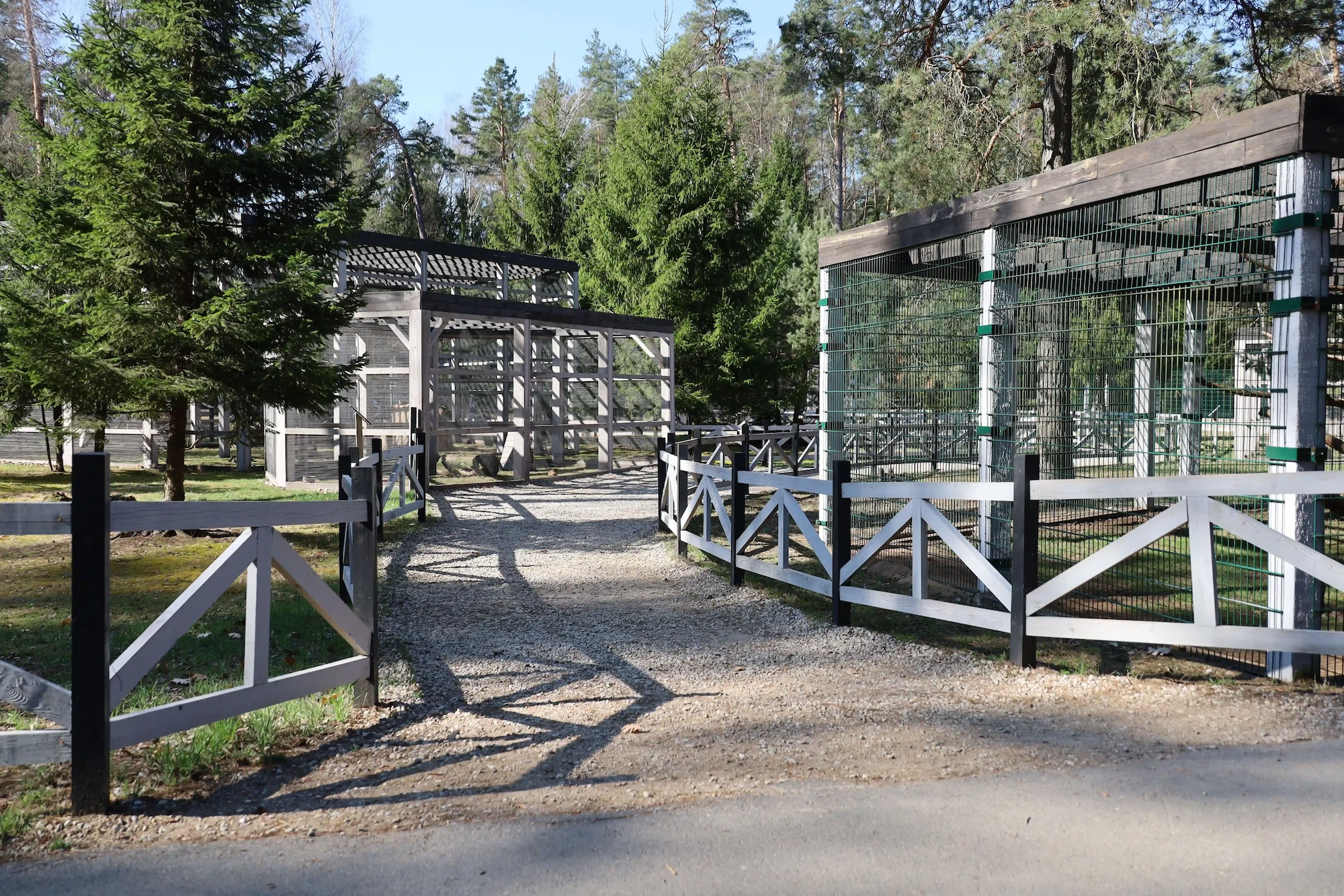
«Green Corridor» route was created to separate different high-speed traffic flows and is specifically designed for tourist travel through Belovezhskaya Pushcha on private or rented electric vehicles, classified as personal mobility vehicles. The route also passes through attractive areas, with landscapes alternating from sunlit coniferous forests to shaded oak and hornbeam forests. The route is equipped with gazebos and information boards. The entire route runs along a paved road.
1.Kamenyuki (52.548070, 23.822310)
Kamenyuki settlement is located in the floodplain of the Pravaya Lesnaya River.
Originally, the area consisted of two adjacent settlements: the peasant-owned village of Borodichi and the state-owned village of Kameniki. They were separated by streams flowing into the Pravaya Lesnaya River and marshy areas, which were reclaimed in 1970.
State-owned houses and infrastructure buildings of the “Korolev Most” were located nearby, not far from the river and the bridge over the Pravaya Lesnaya River.
Korolev Most was first mentioned in a charter from King Sigismund Augustus, granted to the nobleman Ostafiy Vlasyevich Novitsky for the Klekovichi estate with entrances to the Pushcha, dated February 7, 1558.
In 1928, Kameniki was merged with Korolev Most into a single village, Kamieniki.
2.Village Pashuki (52.523160, 23.851346)
It is documented that in 1494, the neighboring «Shishov estate» was owned by Maina Pashukovich, a Volyn landowner. It remains unclear whether this man or a relative with the same surname held title to Pashuki. If so, the village of Pashuki took its name from the surnames of these landowners.
Pashuki estate was officially mentioned in the 16th century in the “Description of the Royal Forests” in the former Grand Duchy of Lithuania.
The next significant mention of Pashuki dates back to 1609. It was marked by the construction of the Uniate church “Podbelskaya in Pashuki.” The sponsor and initiator of the construction was the owner of the Pashuki estate, Agafia-Zofia Bogdanovna Pats (from the Sapieha family). The church was consecrated in honor of the Nativity of the Virgin Mary.
Currently, the village of Pashuki is a small village in the forests. The most significant landmark in the village is St. Andrew’s Church. Built in 1877, it is a monument to the retrospective Russian style. It consists of four parts, which are successively connected to one another: a bell tower, a refectory, the main building, and an apse.
In the early 1990s, St. Andrew’s Church was renovated and consecrated, thus reviving the Pashukovsky parish.
3.Pashuki checkpoint (52.527489, 23.860392)
Nowadays, the Pashuki checkpoint not only serves as a security checkpoint but also serves as an information and tourist point where you can get answers to your tourist questions.
4.Village of Pashutskaya Buda. (52.531737, 23.869056)
The village of Pashutskaya Buda has been known since the time of the kings of the Polish-Lithuanian Commonwealth. In the past, there was no permanent settlement here, but seasonal “pushcha” workers lived in “budas” – temporary dwellings and huts.
In the 1920s, a narrow-gauge railway ran near the village, transporting timber to two sawmills (in Lisuvshchyla and “beyond the swamp”).
The village of Pashutskaya Buda was burned down twice: during World War I and World War II but was rebuilt by local residents.
The administrative building of the Pashukovsky Forestry District, with guest rooms, is located on the grounds of Pashutskaya Buda. Overnight accommodations can be arranged here by prior arrangement (phone: 80163197030).
5.Village Gvozd 1 and village Gvozd 2 (52.533969, 23.893172)
There are small villages with the unusual name of Gvozd (Nail) in the southern part of Belovezhskaya Pushcha. For many years, the etymology of these villages remained unknown.
It is said that the name is directly connected to the first settler of this village, Sedun, although he initially lived there without a surname.
This was during the era of serfdom, when serfs were distinguished from each other only by their first name, nickname or owner’s name.
When serfdom was abolished, census takers – the predecessors of today’s census takers – were dispatched to all corners of the country. They visited every house and meticulously recorded all the inhabitants. The family was also given a suitable surname.
When the census takers had visited all the settlements in the Pushcha and had already completed their work in the village of Pashuki, one of the residents suddenly remembered that there was still one person hidden in the forest uncovered. Imagine their surprise when they saw a genuine forest man before them. Naturally, their first question was how long he had been living in such a remote place.
“I’ve been here a long time,” the forest man replied.
“Well then!” said the census takers. “In that case, we’ll give you the name Sedun.”
“And are you living here all alone?” the census takers inquired.
“Yes, alone as a nail,” replied the newly minted Sedun.
So the census takers named the forest hermit’s refuge the “Nail” farmstead. Thus, a new settlement emerged in the forest, a name that has retained to this day.
6.Village of Podbelskie Ogorodniki (52.530136, 23.901269)
Ogorodniki (there are five such names in the Kamenets district) originate from a social group of impoverished “peasant gardeners” who owned small plots of land, which emerged in the 14th century.
The village of Podbelskie Ogorodniki is located near the village of Podbela. In the summer of 1915 (during World War I), the village was burned down, and the residents were forced into exile.
During World War II, the Nazi occupiers evicted the local residents (as well as the rest of the Pushcha villages) but did not burn all the buildings. They left a few houses intact, housing workers who collected firewood. A small German garrison was also stationed in Podbelskie Ogorodniki.
After the end of World War II, the village was restored.
7.Forest guard house (52.541084, 23.911202)
Forest protection has been established in the forest since the time of Jagiello. The first mentioned guard, settled in the forest, consisted of 277 families. Riflemen were called upon for hunting trips. They controlled the “entrances” to the forest, i.e., the right to use the land. Their work was rewarded with the right to use the land. Later, around the 17th century, the forest guards and mounted guards were responsible for protecting the forest and maintaining communications and infrastructure.
In the 18th century, under Augustus III, the Jäger Service and riflemen maintained order.
Under Tiesenhaus, forest protection was entrusted to hunters, fortmasters, and riflemen.
When the forest was transferred to the Russian Empire, the forest protection system took on a form similar to today’s. It was headed by a manager who supervised the foresters. Foresters, in turn, managed the forest’s lands through the supervision and operation of assigned patrols, for which patrolmen-foresters were responsible.
Here, to the left of the road, at 889 sq. m., you can still find the remaining foundation of the forest guard’s lodge, which for a long time monitored the road and restricted encroachment on the primeval forest and its inhabitants.
8.The road to the Kryzhyk tract (52.552742, 23.938217)
The tract has long been forgotten, and only echoes of the past can be found on old maps. The crossroads is a traditional meeting place and meeting place. This crossroads was strategic from the 16th to the 20th centuries. It was crossed by roads from the village of Pashuki to the village of Krynica, while a second road connected the villages of Korolev Most and Yasen.
Now, a large feeding area for bison and deer is located nearby. Predators also frequent the area, and birds flock here to feed.
Near the feeding area, you can see fallen pine trees, white with the teeth marks of various animals. This is how forest dwellers replenish their vitamin C intake during the cold season.
9.Dubrovoje (Oak) tract (52.567227, 23.938178)
This area has long been inhabited. When exploring the landscape of this patch of land, you can see traces of economic activity: vegetable gardens, a cellar pit; old maps indicate a well here, where horses were watered and water was collected. Even during Soviet times, a two-apartment government-owned house stood here, home to foresters Shokhalevich and Sokolovsky, who were responsible for their patrols in the forest. Such places used to be called «cordons.»
10.Old tar kiln (52.567567, 23.938296)
When examining maps of the Belovezhskaya Pushcha, you’ll notice settlements with the names Budisko, Budy and Pashutskaya Buda, while in the villages surrounding this ancient forest, you’ll often encounter people with the surnames Budnik and Budkevich.
The origins of the terms «buda» and «budnik» in the Belovezhskaya Pushcha are linked to the production of charcoal, tar and resin. In the forest, this process occurred as follows: tree stumps and various timber harvesting scraps were piled into a small depression. The pile was then covered with forest litter, lined with moss and turf, compacted with sand, and set alight. The result was a kind of closed oven, in which, under high temperatures and without oxygen, the wood slowly smoldered, turning into charcoal, while resin, turpentine, or tar collected at the bottom. A loaded, lit kiln (or tar kiln) could smolder for several days, then the sand would be raked away, the resulting product collected, and the kiln reloaded. All of these products were readily purchased, making production virtually waste-free and quite profitable. Operating such a kiln required three to five people, who had to constantly monitor its operation. Therefore, they settled nearby in primitive semi-dugout dwellings, sheltered by logs and brushwood. Locals called such dwellings “budas,” and the workers who lived in them “budniks.”
Today, in addition to the names of settlements and surnames, the remains of such kilns have also been preserved in the forest—true monuments to the history of Belovezhskaya Pushcha.
11.Monument to Kovpak’s partisans (52.569286, 23.938210)
Advancing toward the western borders in 1944, Kovpak’s division decided to use the forest roads of the Belovezhskaya Pushcha as a maneuvering area. However, upon approaching the protected forests, the partisans decided not to enter the thicket en masse, but sent four scouts. This was the right decision, as upon discovering the scouts as they delved deeper into the forest, the Germans met them with crossfire. Two scouts then hurried back to warn their comrades of the danger, while the other two fought an unequal battle, covering their retreat. Tragically, both remaining partisans were killed in the 833rd quarter of the Pashukovsky forestry. An obelisk now stands at the site of the April 1, 1944, battle in honor of Vasily Ivanovich Korobko (born in 1927) and Pavel Alexandrovich Sychev (born in 1921). The soldiers themselves are not beneath it. Their bodies rest in a mass grave in the village of Rozhkovka in the Kamenets district.
Eternal glory to the brave partisans!
Phone: +375 33 399-19-32
E-mail: admin@npbp.by
 Gazebos
Shop
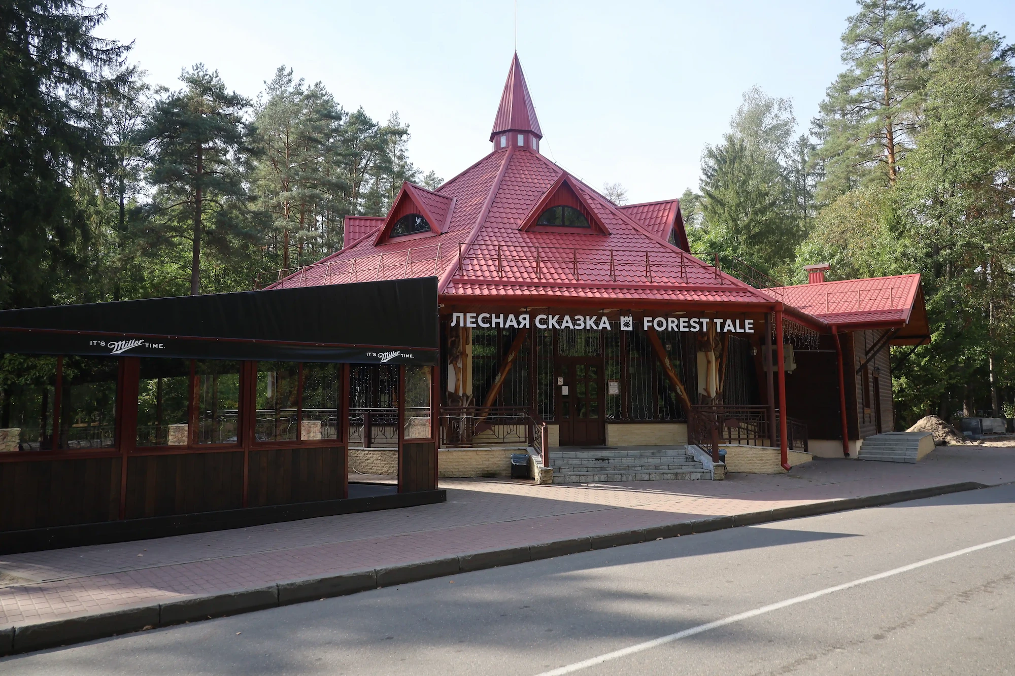
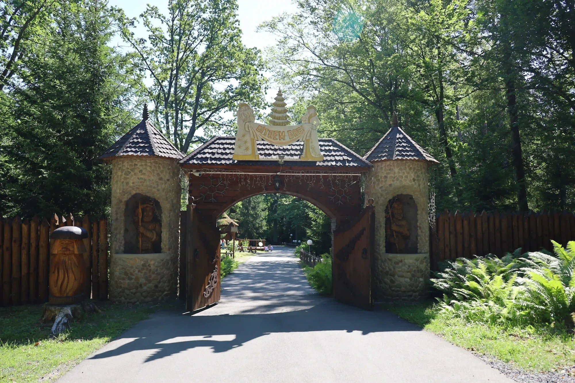
Santa Claus's Estate
The route is equipped with information boards
Gazebos
Shop
Santa Claus's Estate
The route is equipped with information boards
Log in to leave a review.